Resort · Upscale
Arcadia Bluffs
On the Lake Michigan bluffs along M-22 south of Arcadia
A golf resort high on the Lake Michigan bluffs near Arcadia, with lodge rooms in the clubhouse, a second lodge and cottages.
Confirm details before booking
Great Lake · Grand Haven to the Straits
The big lake that shapes this coast: state park and town beaches from Grand Haven to Charlevoix, harbor towns with city marinas, and pier lights to walk out to.
Lake Michigan shapes this whole coast. You get dune shores, state park beaches, harbor towns with pier lights to walk out to, and open water for boating and fishing, from Grand Haven north to the Mackinac Bridge. It is the only Great Lake that lies entirely within the United States.
Most towns on this shore have a public beach within reach of downtown. Heading north:
Farther north, the beaches on Little Traverse Bay and Grand Traverse Bay have their own pages. State park beaches have no lifeguards, and not every park has a buoyed swim area, so read the safety notes below before you go.
The harbor towns grew where rivers or inland lakes reach the big lake, so most marinas sit on protected water with a channel out. City marinas with transient slips include Grand Haven, Muskegon, Pentwater, Ludington, Manistee, Arcadia, Frankfort, Leland and Charlevoix. Leland’s harbor is right on the open lake beside Fishtown. For the bays and the Straits, see Petoskey, Harbor Springs and Mackinaw City. Many marinas book through the state reservation system, and fuel and pump-out vary by harbor, so check each one before you plan a run.
Before you head out, carry life jackets, file a float plan and bring a phone or marine radio.
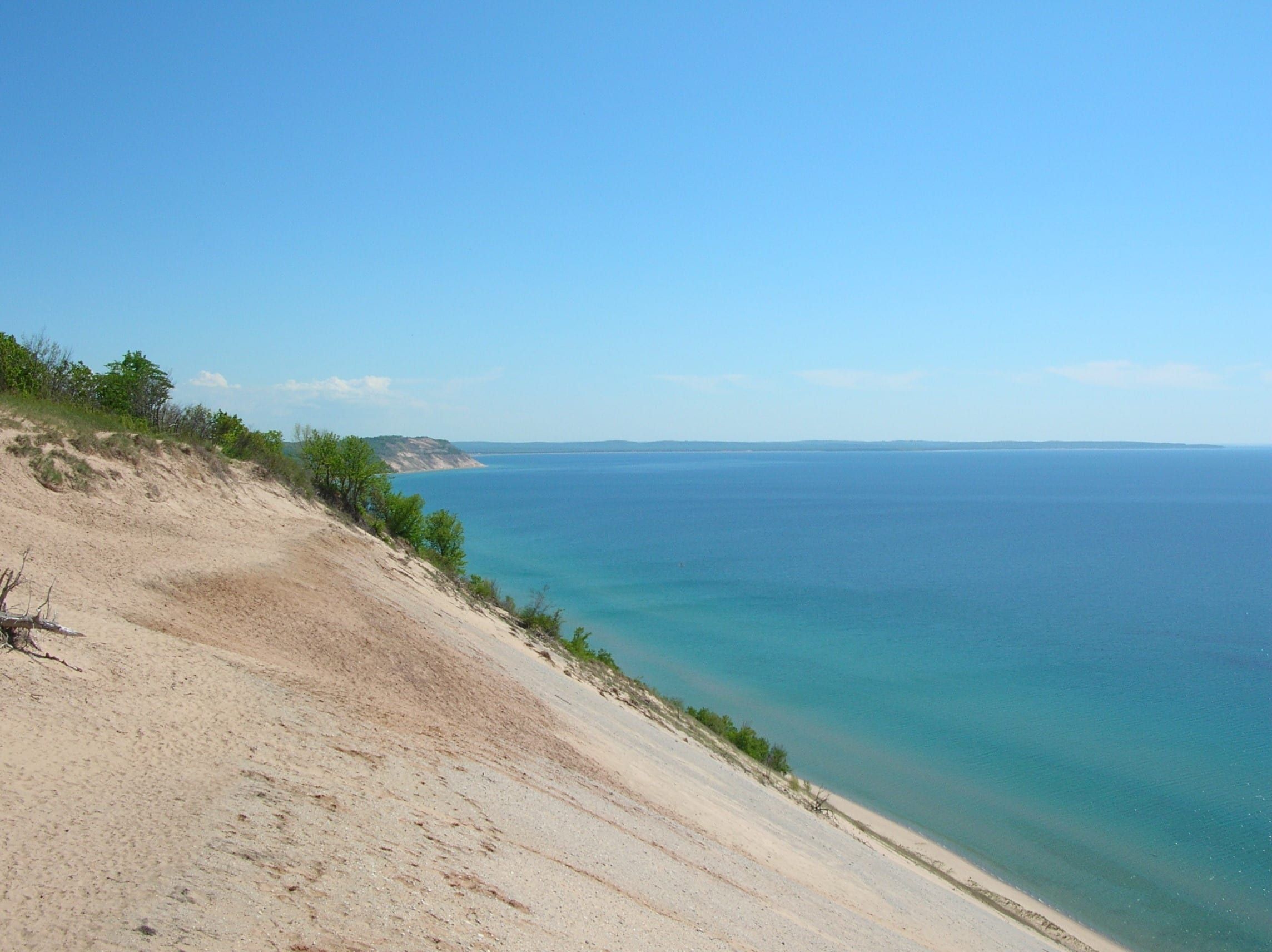
Sand defines much of the shore. Michigan’s environmental agency describes the state’s dunes as the largest collection of freshwater dunes in the world, formed as glacial sand washed onto the beaches and westerly winds pushed it inland. U-shaped parabolic dunes are the most common form along the Lower Peninsula’s Lake Michigan shore. At Sleeping Bear, the dunes sit perched on bluffs high above the water.
Grand Haven, Ludington, Manistee, Frankfort and Charlevoix mark their channels with pier and breakwater lights that are now popular walks.
Treat the lake with respect. Rip and structural currents and high waves can form along beaches, near river outlets and beside piers and breakwalls. When waves push water along the shore and it meets a pier, it turns out into the lake, and that can carry a swimmer into deep water with little chance of escape. Stay at least 100 yards from piers, never jump off them, and stay off them when waves wash over, because waves can sweep people off. The DNR has named the beaches at Grand Haven, Ludington and Mears state parks among places where rip currents tend to build.
If a current catches you, flip onto your back and float, and keep calm. Follow the current to see where it runs, then swim at a right angle to it. Swim in a buoyed area where there is one, check the beach flag often because conditions change quickly, and check the National Weather Service’s Great Lakes beach forecasts before you go.
In winter, admire the shelf ice from the beach. It looks solid but is not, and first responders ask everyone to stay off it.
The scale is hard to take in. The Tip of the Mitt Watershed Council gives it a length of about 307 miles, a maximum depth of 923 feet and roughly 1,659 miles of shoreline. It joins Lake Huron through the Straits of Mackinac, and the Mackinac Bridge is customarily treated as the line between the two lakes. This guide follows the eastern shore, and the map pin marks a point offshore near the middle of that stretch.
Town by town, the main public beaches are Grand Haven State Park at the mouth of the Grand River; Pere Marquette Park and Muskegon State Park in Muskegon; Charles Mears State Park in Pentwater, with a designated swim beach; Ludington State Park, which lists swimming beaches; First Street and Fifth Avenue beaches in Manistee; Captain John Langland Park in Onekama; the public beach at the west end of Main Street in Frankfort; Empire Beach at the foot of Niagara Street; and Michigan Beach near the South Pier Lighthouse in Charlevoix. State park beaches have no lifeguards, so swim in a buoyed area where there is one and check the beach flag.
State parks give you much of the public access on this shore, among them Grand Haven, Muskegon, Charles Mears at Pentwater, Ludington and Petoskey. Sleeping Bear Dunes National Lakeshore protects about 65 miles of shoreline in Benzie and Leelanau counties. State park beaches have no lifeguards, and not every park has a buoyed swim area.
Harbor towns along the coast sit where rivers and inland lakes meet the big lake, so many marinas and launches are on protected water with a channel out to Lake Michigan, as at Grand Haven, Ludington, Manistee and Arcadia. Before you head out, carry life jackets, file a float plan and bring a phone or marine radio.
Winter is for the shore, not the water. Shelf ice builds along the beaches, but it is unstable, with cracks, hidden holes and open water underneath, and cold water shock can set in within minutes if you fall through. First responders ask people to stay off it entirely and to call 911 rather than attempt a rescue. Inland, Muskegon State Park runs a luge track, skating trail and ski trails, and Ludington State Park lists cross-country skiing and snowshoeing.
City marina on the Grand River beside Chinook Pier, with most slips set aside for transients and a pump-out listed. Booked through the DNR harbor system.
Muskegon's city marina on Muskegon Lake, the protected harbor behind the Muskegon Channel, with seasonal docking, transient moorings and a pump-out cart.
Village marina on Pentwater Lake in the middle of downtown, inside the channel to Lake Michigan, with transient, seasonal and charter slips and a pump-out.
City marina on Pere Marquette Lake a couple of blocks from Lake Michigan, with transient and seasonal slips and broadside dockage for larger boats.
City marina on the Manistee River beside the downtown Riverwalk, with transient slips and broadside space, gas and diesel, and pump-out.
Small township marina on Arcadia Lake with an inlet to Lake Michigan, taking transient reservations, with marine gas and diesel and pump-out.
City marina and launch ramp on Betsie Lake, the harbor at the mouth of the Betsie River.
Township-run harbor right on Lake Michigan beside Fishtown, with gasoline, diesel and pump-out.
City marina on Round Lake in downtown Charlevoix, between Lake Michigan and Lake Charlevoix, with 77 slips mostly reservable for short stays; fuel and pump-out come from the boatyard next door.
Fishing, launching at a state site or parking at a state park? See licenses and passes for what you need before you go.
Anything not listed here is unverified. Lake Michigan conditions change fast: check local beach and wave forecasts, follow posted flags and warnings, and stay off piers in high waves.
Cold water and wind can delay the spring installation of swim buoys, so early in the season you will often find no marked swim area.
Swim buoys usually go in at state park beaches from Memorial Day weekend through Labor Day, and parks with buoyed areas fly green, yellow, red and double red beach flags. Under double red flags, you may not enter the water from the beach.
Once the swim buoys come out for the season, the beach is no longer a designated swim area. Some lighthouses stay open into fall on reduced schedules, and Lakeshore Keepers opens Big Sable Point on select days into late October.
Activity moves onto land. Muskegon State Park's adventure sports park runs a luge track, skating trail and cross-country ski trails, and Ludington State Park lists cross-country skiing and snowshoeing.
Map of Lake Michigan
15 places on an OpenStreetMap map
Each lakeshore town has its own hotels, inns and local rental managers, many with homes right on the beach.
Resort · Upscale
On the Lake Michigan bluffs along M-22 south of Arcadia
A golf resort high on the Lake Michigan bluffs near Arcadia, with lodge rooms in the clubhouse, a second lodge and cottages.
Confirm details before booking
Resort
On the Lake Michigan beach in downtown Frankfort
A beachfront resort hotel in downtown Frankfort on the site of the Royal Frontenac Hotel, which the Ann Arbor Railroad opened in 1902.
Resort · Upscale
On the Lake Michigan shore on Scenic Drive, Whitehall
A long-running cottage resort on Lake Michigan near Whitehall, with guest buildings spread over wooded acres above the beach.
Confirm details before booking
Resort · Upscale
On Lake Michigan in Glen Arbor
A four-season resort in Glen Arbor on about a mile of Lake Michigan shoreline, surrounded by Sleeping Bear Dunes National Lakeshore.
Straight-line distances from the map point.
State park
A 48-acre sand beach park where the Grand River meets Lake Michigan, with a swim beach, a modern campground and views of the pier lighthouses.
About 100 miles away (straight line)
Lighthouse
Two red range lights on Grand Haven's south pier, joined by an elevated catwalk, marking the harbor entrance where the Grand River meets Lake Michigan.
About 100 miles away (straight line)
State park
A big dune park between Hamlin Lake and 7 miles of Lake Michigan shore, with three campgrounds, 21 miles of trails and the walk to Big Sable Point Lighthouse.
About 30 miles away (straight line)
Lighthouse
An 1867 lighthouse, 112 feet tall and banded black and white, on the Lake Michigan shore in Ludington State Park. You reach it on a 1.8-mile walk or ride.
About 30 miles away (straight line)
Attraction
A 1953 coal-fired steamship and National Historic Landmark that carries passengers and vehicles across Lake Michigan between Ludington and Manitowoc, Wisconsin.
About 35 miles away (straight line)
State park
A bluff-top park north of Manistee for Lake Michigan sunsets, forest trails and camping. Despite the name, you cannot reach the beach from the park.
About 20 miles away (straight line)
Lighthouse
Manistee's 38-foot pierhead light at the end of the north pier. Tower climbs began in 2026; the tower is now listed as closed until May 21, 2027.
About 20 miles away (straight line)
Nature preserve
3,927 acres of dunes, forest and grassland on Lake Michigan, with more than 15 miles of trails and an accessible path to a lake overlook.
About 20 miles away (straight line)
Lighthouse
A 67-foot square steel lighthouse at the head of Frankfort's north breakwater, marking the harbor entrance in full view of the city beach.
About 25 miles away (straight line)
Lighthouse
An 1850s brick lighthouse on the Lake Michigan shore north of Frankfort, with a museum, a climbable tower and a public beach beside it.
About 25 miles away (straight line)
National park
Dunes, high bluffs, beaches, inland lakes and two islands along 65 miles of Lake Michigan shoreline in Benzie and Leelanau counties.
About 40 miles away (straight line)
Lighthouse
A red steel pierhead light where Charlevoix's Pine River Channel meets Lake Michigan, beside Michigan Beach and a favorite place to watch the sunset.
About 90 miles away (straight line)
State park
A mile of Lake Michigan beach on Little Traverse Bay between Petoskey and Harbor Springs, with wooded dunes and the climb up Old Baldy.
About 110 miles away (straight line)
Bridge
The five-mile suspension bridge that carries I-75 across the Straits of Mackinac between Mackinaw City and St. Ignace, open since November 1, 1957.
About 135 miles away (straight line)
May we count your visit with Google Analytics? It helps us see which guides are useful. Nothing is collected unless you choose Allow. Details
Your browser sends Global Privacy Control, so analytics stays off and we will not ask again.